What is Georeferencing?
Geoferencing is the process of connecting your images (e.g. aerial photographs, scanned maps, satellite images) with their spatial locations on a reference dataset or so called "coordinate system". In other words, adding these geographic information to the image or map will enable GIS software to "place" it in its appropriate real world location. This way we will be able to view, make queries, and analyze our data with other geographic data.
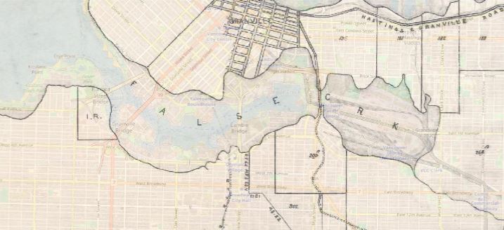
Example: how has False Creek changed since the 19th Century?
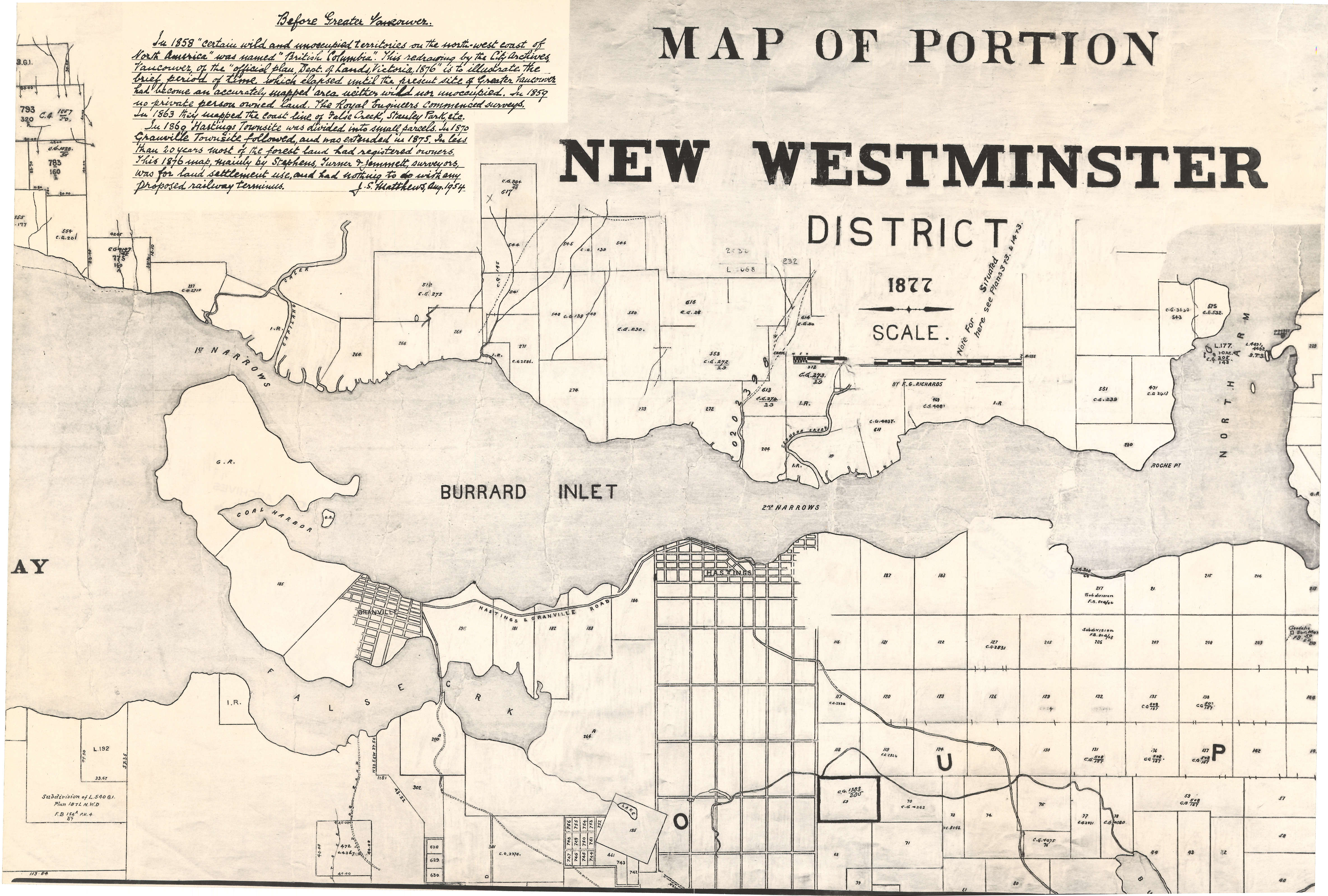
Why is georeferencing necessary? Imagine you want to explore how False Creek has changed since the 19th Century. To achieve that, you need to find an old map of False Creek and compare it with the current situation. Fortunately, you found a digitized map from the City of Vancouver Archives that captures the configuration of False Creek in 1877 (see the image below). Now you need to georeference the image, which means to associate some features on the map with real world x and y coordinates so that it can be overlaid with other spatial datasets (i.e. a recent map of Vancouver).

Source: Map of portion New Westminster District (1877), City of Vancouver Archives
After you georeferenced the historical map, it will be overlaid properly with a current map, and now you can easily see how False Creek has changed:

Tutorial: using QGIS to georeference the historical map
Basically, georeferencing involves two steps:
1) Add control points that link locations on the raster dataset with locations in the spatially referenced data (target data).
2) Select a transformation method that will shift the raster dataset from its existing location to the spatially correct location.
Watch this video or refer to this guide to learn how to do georeferencing with QGIS.
Notes:
- QGIS is a free-and-open-source GIS program that runs on Unix platforms, Windows, and MacOS. You can download QGIS from its website.
- In the tutorial, we will use the historical map shown above as an example. You may want to download the map from City of Vancouver Archives.
Newest development in Georeferencing: web-based approach
Allmaps, a web-based platform, allows users georeference any digitized map from any institutions that ahere to IIIF. No GIS software is required- all you need is just an IIIF image URL. No account is needed.
