
Georeferencing is the process of connecting images (e.g. aerial photographs, scanned historical maps, satellite images) with their geographic locations in a coordinate system so that the images can be used as spatial layers in GIS software. This workshop will arm you with the skills needed to georeference image files in ArcGIS so that you can view, make queries, and analyze your image-based data with other geographic data.
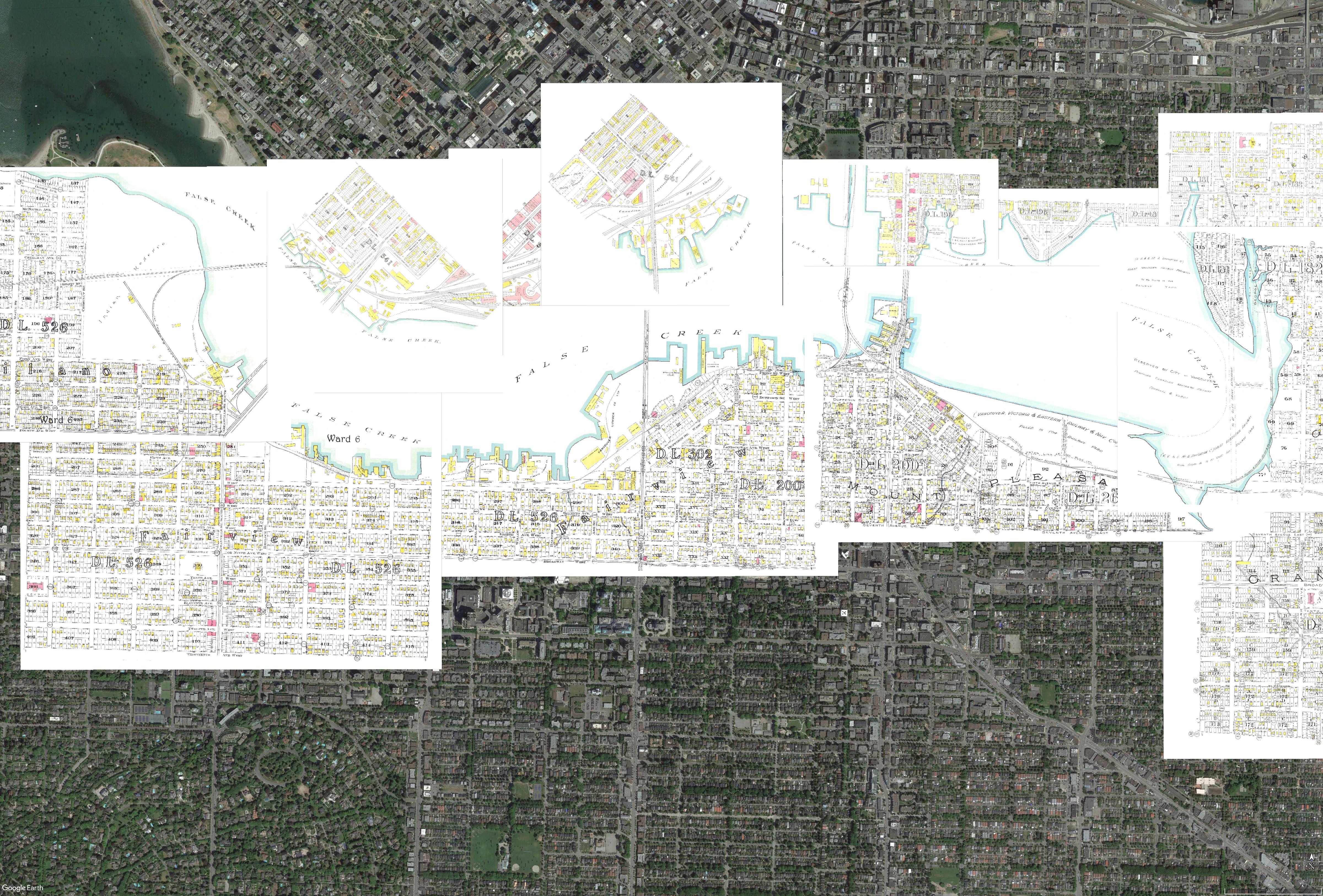
Image: Georeferenced images of Goad’s 1912 Fire Insurance Map of Vancouver, showing the original shoreline of False Creek.
Date(s)
June 7
Time
1:30pm - 3:00pm
Location
Lab 2105, Bennett Library, Burnaby
Registration information
Aimed at graduate students, but open to all. Register here.